 Skip to content
MACHIAS BAY
Discover fishing harbors, meandering rivers, historic pre-Revolutionary sites, and classic New England towns.
Coming into the Machias Bay area
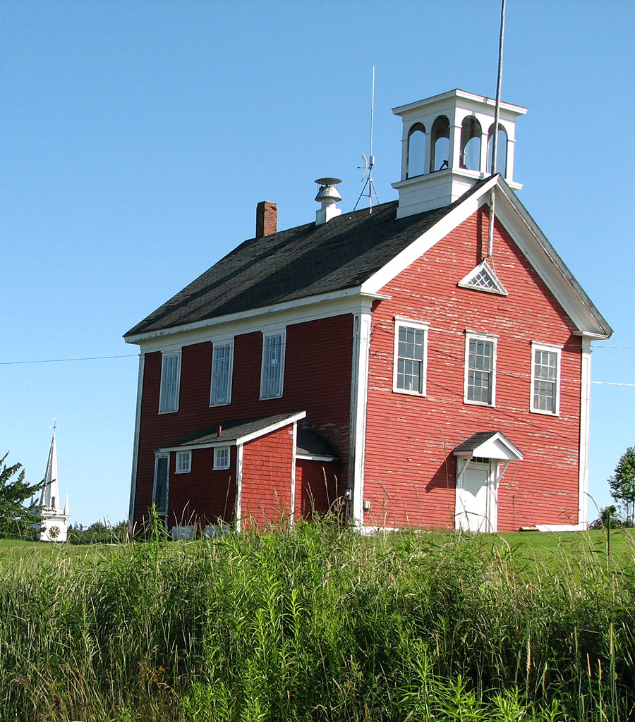
As you arrive in the Machias Bay area traveling along U.S. 1, the first village along the way is Whitneyville. Tucked away on the Machias River is a pretty village with a red schoolhouse, a white-steepled church, and a historic lumber mill. Whitneyville also offers easy access to the 5.5 miles of hiking trails in the Machias River Preserve, part of the Downeast Coastal Conservancy, and access to the popular multi-use Down East Sunrise Trail.
A small town north of Machias, Marshfield boasts a beautiful setting on the Middle River; the town is also home to Auger Hill Farms maple producers and the Maine Natural Sea Salt Company, which offers free tours from May through May October.
Just up Route 192, Northfield has excellent water resources, including the Machias River, Long Lake, Bog Lake, and Fulton Lake. Fishing and boating are lovely ways to enjoy this small, rural community.
IN Machias...History Comes to life
Incorporated in 1763, the village of Machias exudes history. Each June, the community celebrates its role in the Revolutionary War as the site of the first Naval Battle with its Margaretta Festival.
The event commemorates the June 12, 1775 skirmish between the well-armed HMS Margaretta and the ships Falmouth Packet and the Unity. Under the command of local Captain Jeremiah O’Brien, the Unity overtook the Margaretta, and a battle ensued wherein James Moore, a midshipman in control of the vessel, took fire and was wounded in action. The now leaderless British forces quickly surrendered.
Two years later, in an act of vengeance called the Battle of the Rim, the British were repelled by the combined forces of the local Patriots and Maine’s own Passamaquoddy. Today, in addition to the events of Margaretta Days, a local living history group with members that trace ancestry to the original battle’s participants gather to re-enact scenes from the Battle of the Rim.
Machiasport is home to Fort O’Brien State Park, built overlooking the site of the first naval battle of the American Revolution. It remains a coastal port reliant on natural resources from the land and the sea for its survival.
Thanks to the site Revolutionary War and Beyond. Visit their site for complete details on The Battle of Machias.
The machias area TODAY
Throughout Machias, you will also find an eclectic and vibrant collection of galleries, welcoming restaurants, shops, and services of all kinds.
Don’t miss Jasper Beach, a unique gravel beach of polished pebbles. Travel down the peninsula to Bucks Harbor and Starboard. If you have the opportunity, explore the harbor and its many islands by boat from one of the many public boat access points throughout the peninsula.
Situated where the Machias and East Machias rivers meet Machias Bay, East Machias is a lovely historic village. Enjoy the village’s thirty-two landmark buildings, and perhaps stay in one of the area’s several charming inns and B&Bs. Visit the East Machias Aquatic Research Center, operated by the Downeast Salmon Federation.


Roque Bluffs
Roque Bluffs is a small town offering spectacular ocean views and fresh and saltwater beaches. Part of Jonesboro until 1891, the town’s shoreline is often draped at twilight in a soft fog that adds to the community’s allure.
A small coastal fishing village where lobstermen, scallop draggers, mussel draggers, urchin divers, and clammers still go down to the sea to make their living. This mostly rural area is also home to Welch Farm, a family-owned blueberry farm where visitors are invited to learn about the history of blueberry farming in Maine; visit the Welch Farm website to schedule a tour in advance.
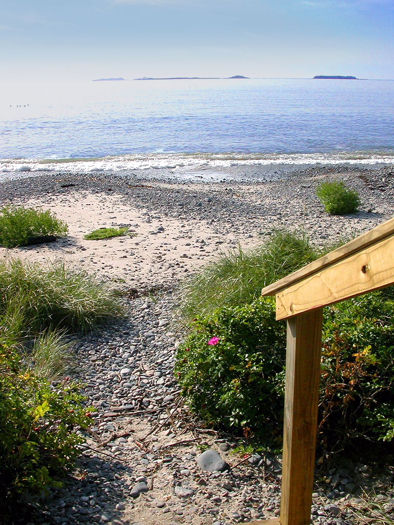
While you are here, visit Roque Bluffs, State Park. A beautiful half-mile crescent of sand and pebbles along Englishman Bay is backed by the shallow waters of 60-acre Simpson Pond, allowing for bracing saltwater swims and much warmer freshwater soaks. The sand/pebble beach here is an unusual geologic feature along the coast. It resulted from an accumulation of sediment eroded from a prominent glacial moraine lying east. There is a bedrock outcrop at the beach’s eastern end where visitors can see glacial striations.
trip itinerary from wayward travel:
Planning Tools
To help you plan your trip we provide information on drive time and distances to and around the region. Plus info on other commercial transportation options.
Once you arrive in DownEast Acadia, you will want to access local sources of visitor information, state laws, recreation rules, and road conditions.
To help you pack or plan your day, check out the current weather in the region or learn about year-round averages of temperature and precipitation.
