 Skip to content
Schoodic to Jonesport
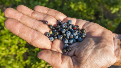
Discover a diverse terrain formed by glaciers: wild blueberry barrens, granite domes, and a rugged shoreline.
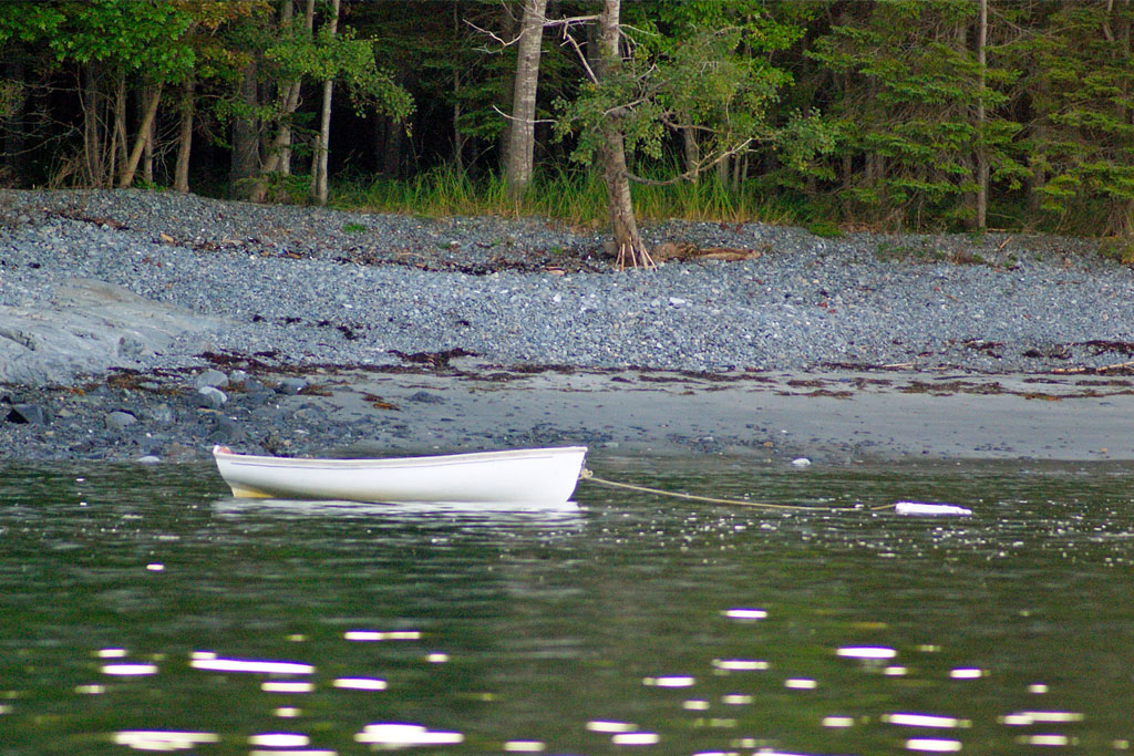

Schoodic peninsula
Considered the gateway to Schoodic Peninsula, Hancock is designated as U.S. Route 1’s western starting point for the Schoodic National Scenic Byway. Once known for its fishing fleet and granite industry, it now boasts unique local shops, restaurants, and accommodations. The town hosts numerous annual festivals, fairs, and even church suppers.
Located on Frenchman Bay, Sorrento is a popular fishing and resort community that offers spectacular views of Bar Harbor and the mountains of Mount Desert Island to the southwest. The local 9-hole public golf course first opened in 1916 and densely forested Preble Island, located just off-shore is known for its cobble beaches and roosting eagles.
Winter Harbor is a traditional fishing village with a year-round population of fewer than 1,000 people. The town got its name because the harbor does not freeze over in winter, making it an attractive port for fishermen. Even now it’s still home to an active fleet of lobster boats. Every year, on the second Saturday in August, residents celebrate with the Winter Harbor Lobster Festival. You can enjoy lobster boat races, shop at a craft fair, eat a Maine lobster dinner, and watch a parade.
Gouldsboro consists of many historically separate fishing villages, summer colonies, and communities of the Schoodic Peninsula. The town covers an area from Frenchman Bay—including Long Porcupine Island, Sheep Porcupine Island, Bald Porcupine Island—east to Gouldsboro Bay.
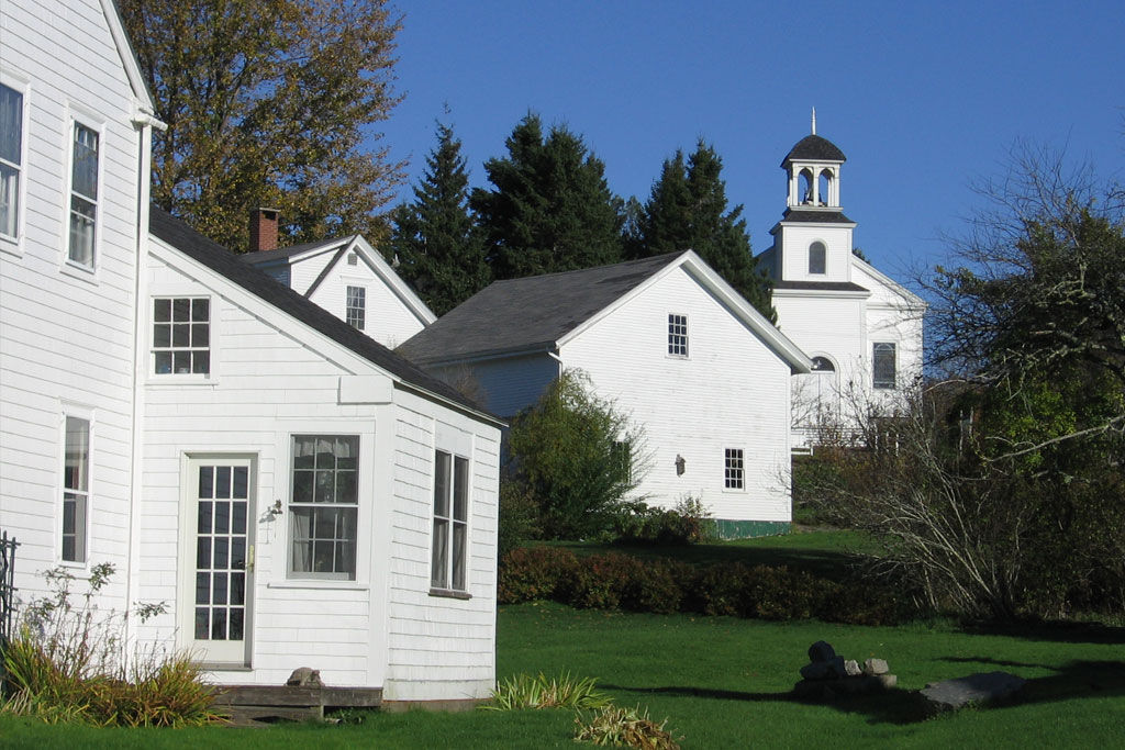
Historic Villages and towns
Steuben is a small historical village whose heart is the village green with its church, school, and library. This coastal community, settled in 1760, occupies many little fingers of land that jut out into the Gulf of Maine. Paddle by kayak through the Maine Coastal Islands National Wildlife Refuge or hike the Pigeon Hill Preserve trail for great views of Petit Manan Island and Lighthouse.
Cherryfield’s downtown historic district sits on over 75 acres spanning both sides of the Narraguagus River and is known as the Wild Blueberry Capital of the World! The town contains antique and gift shops, and is home to Catherine Hill Winery—in fact the Blackwoods Scenic Byway is bookended with wineries with Shalom Orchard Organic Farm Winery just a stones throw from the byway to the west, in Franklin.
Downtown Milbridge contains many historic 19th century homes, including the former home of Maine blueberry baron Jasper Wyman. The community has an active fishing harbor situated at the mouth of the Narraguagus River and offers opportunities to enjoy the local seafood or wildlife-watching boat tours. The town also marks the western start of the Bold Coast National Scenic Byway.
First settled in 1765, Harrington is a quiet coastal village with lovely old homes. The Frank E. Woodworth Preserve trail winds through moss-carpeted woodlands then emerges at the shoreline overlooking the upper reaches of Pleasant Bay. Several tidal rivers converge off Ripley Neck, supporting a wide array of shorebirds and waterfowl.
It might be the smallest organized town in Maine, but Beddington has a lot to offer visitors. Its rivers and lakes, which make up over 10% of the area, are part of a salmon spawning migratory path, and the surrounding land area is primarily blueberry fields. Located along Route 9—familiarly called the Airline—the surrounding area abounds with wildlife, and it is famous for fishing, hunting, ATV, and snowmobile enthusiasts.
Deblois, incorporated in 1850, is situated away from the coast between Cherryfield and Beddington, along Route 193. Blueberries barrens and farms line the gentle hills of this area. The east branch of the Narraguagus River flows through the township, and the deep forests offer opportunities for the outdoor enthusiast.


Columbia Falls and columbia
The historic town of Columbia Falls is a truly walkable village. The historic Ruggles House Museum showcases a flying staircase and original federal-era furniture. The Wreaths Across America Museum showcases U.S. military items and documents the organization’s history, including its wreath donation program.
Looking for a unique road trip? Head to the Baseline in Epping. In 1807 Congress authorized the U.S. Coast Survey to map the Atlantic seaboard from Maine to Louisiana to aid in navigation and national defense. It was “proposed (that) a survey (be executed) based on a chain of triangles stretching from mountaintop to mountaintop down the Appalachians.”
Known as the Eastern Oblique Arc, it would serve as the framework for linking individual harbor surveys. Six lines were built to facilitate this plan: southwest Alabama, northwest Georgia, the Chesapeake Bay area, off Long Island, NY, Massachusetts, and Downeast Maine. Baseline sites were usually set on open coastal beaches, as a line of about eight miles with visibility at the ends to mountaintops was required. The rugged coast of Maine made it necessary to site its baseline well inland, which has proved to be fortuitous.
The Epping Baseline Road, between Deblois and Columbia, survived while no remnants remain of the other five baselines. The southwesterly marker stone is now housed at the Maine State Museum in Augusta and the Cherryfield-Narraguagus Historical Society is home to the eastern marker.
Jonesport and Beals
Jonesport is a real-life, hardworking fishing village. The neighboring Beals Island offers quiet nature trails and scenic vistas complete with colorful lobster boats bobbing in the harbor. The town’s downtown district is a perfect size to explore on foot, with many opportunities to catch views of the working harbor. Part of the picturesque Bold Coast National Scenic Byway, Jonesport is known for its annual “world’s fastest lobster boat races.”
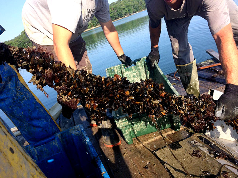
Beals is a hardworking fishing community located on Beals Island, connected by a short bridge with Jonesport. Make a stop at DownEast Institute on Great Wass island—the easternmost marine research laboratory and education center in the United States.
Visitors, school groups, and scientists alike can learn about how the Institute cultures commercially important shellfish seed thus restoring and creating economic opportunities for harvesters, aquaculturists, and other entrepreneurs throughout coastal Maine and beyond. Their facilities include commercial-scale marine research hatchery, running seawater labs, and educational classroom and housing, is available for scientists and others who are passionate about making discoveries in the marine environment.

Planning Tools
To help you plan your trip we provide information on drive time and distances to and around the region. Plus info on other commercial transportation options.
Once you arrive in DownEast Acadia, you will want to access local sources of visitor information, state laws, recreation rules, and road conditions.
To help you pack or plan your day, check out the current weather in the region or learn about year-round averages of temperature and precipitation.
