 Skip to content
Grand Lakes
Discover an inland paradise with a vast network of lakes and forests for the best in outdoor recreation.
The Grand Lakes is a unique destination set apart from the to the rest of the DownEast Acadia. This is an optimal destination for those seeking a retreat from the busy world.

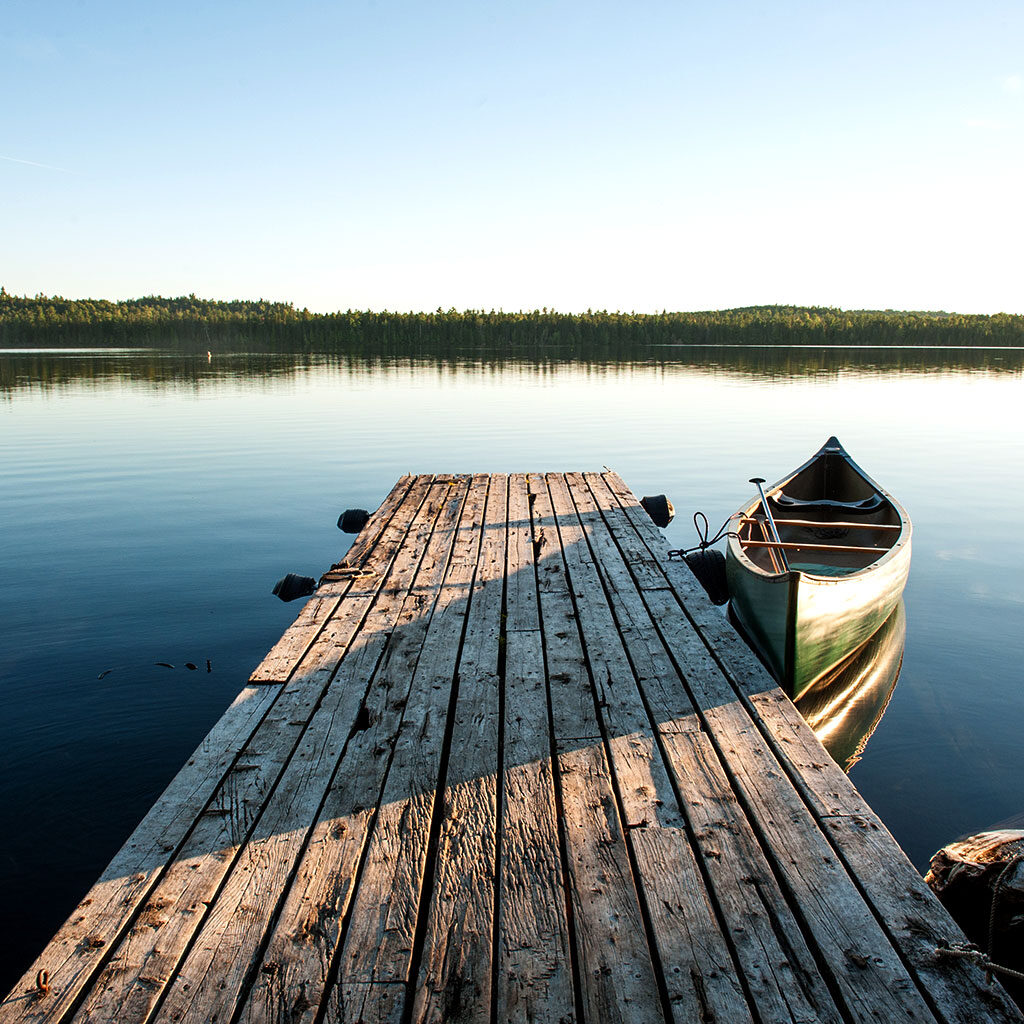
GRAND LAKE STREAM
The small town of Grand Lake Stream is legendary for fly fishing and its traditional Grand Lake Canoe. Situated between West Grand Lake and Big Lake in northeastern Maine, Grand Lake Stream has been attracting outdoor sporting enthusiasts for nearly 200 years. Located in the St. Croix River and Grand Lakes Watershed, the area features over 2.5 thousand square miles of canoe waterways, four major lakes, ten smaller lakes, and 65 islands for fishing, paddling, boating, hiking, and swimming. Plus, the area is home to numerous classic Maine hunting and fishing lodges offering full catering for their guests.
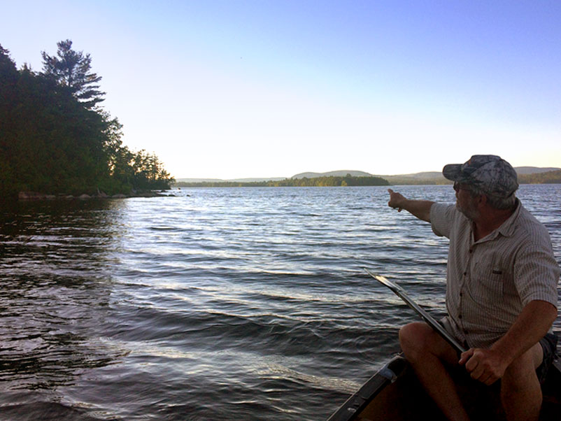
Families can go for a guided stargazing paddle on the lake and experience the incredible peace of the area. The DownEast Lakes Land Trust offers publicly accessible trails for hikers of all skill levels, as well as public educational events and social activities. Visit the Grand Lake Stream Hatchery—where 80,000 landlocked salmon and brook trout are raised each year.
Wesley, alexander, and Meddybemps
As you head into the region from the west on Route 9, also known as The Airline, you arrive in Wesley and Alexander. The drive offers spectacular views of the area’s forests, lakes, and blueberry barrens. Pocomoonshine Lake offers a public boat landing, swimming, fishing, ice fishing, snowshoeing, hunting, and snowmobiling. The nearby Alexander Art Trail allows one to slow down and enjoy a peaceful forest walk among many unique wooden sculptures.
A turn south Route down 191 brings one to the town of Meddybemps. The town is well known for its excellent fishing, boating, and hunting, with Meddybemps Lake bordering on Moosehorn National Wildlife Refuge.
Meddybemps Heath, located near the lake, is the second-largest domed bog ecosystem in the Eastern Coastal and Eastern Interior regions. It has been designated a Focus Areas of Statewide Ecological Significance by the Maine Natural Areas Program, which encourages private owners to be good stewards of such areas.
Along Route 1
Heading north on Route 1, the towns of Baileyville and Woodland lie along the St. Croix River. It is here in Baileyville that paddlers can gain access to the St. Croix International Waterway. This family-centered community boasts four-seasons of recreation.
Nearby Princeton provides access to the west branch of the St. Croix River and a series of lakes celebrated for fishing and hunting. The town is also home to several shops and services.
The hills and lakes surrounding Talmadge, Waite, and Topsfield offer outstanding scenic views and excellent opportunities for sportsmen, particularly during the autumn. From Route 1, it is a short journey east to Vanceboro, a well-known location for fantastic canoeing and kayaking, excellent smallmouth bass fishing, and ice fishing in the winter. It is also the starting point of The Eastern Canoe Trail. There is a bridge with a 24-hour port between Canada and the US and services such as a post office, general store, and gas station.
Maine's Million Dollar View
Deep in the forests and hills of Washington County along Route 1, you’ll find Brookton and Forest City. The general store in Brookton is the nearest spot to stock up before heading out. Forest City is a link between Spednic and East Grand Lakes, part of the Chiputneticook Lake system and headwaters of the St. Croix River. Numerous sporting lodges in the area cater to those who wish to fish, hunt, or enjoy the water.
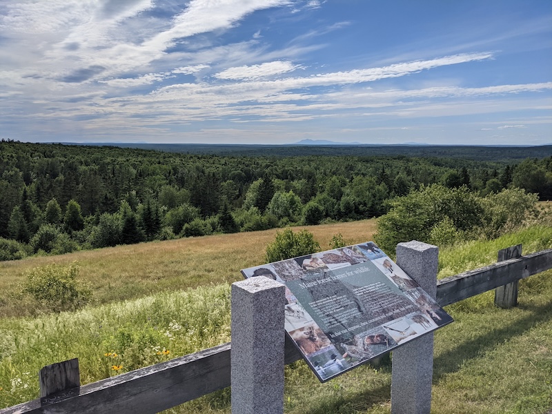
For a good reason, the section of Route 1 through Danforth and Weston is called the “Million Dollar Scenic View.” Stop to soak in the astounding scenery provided by the Chiputneticook Lakes, the headwaters of the St. Croix watershed, and the Canadian shores across the way. Face west for a view as far as Mount Katahdin on a clear day!
In the most northeast corner of the region lies East Grand Lake. Renowned for its beauty and its fishing, you won’t regret a trip to one of the many lodges and cabins in this region. Let local guides enthrall you with their tall tales en route to their favorite fishing spots.
For those traveling through the region seeing out adventure by getting off the beaten path, Danforth is close to many, many trails for hikers and paddlers alike. Plus, the community is a direct link to points north, like Aroostook County and east to New Brunswick, Canada; so those out for adventure should bring a valid passport.
ITINERARY FROM WAYWARD TRAVEL:
Planning Tools
To help you plan your trip we provide information on drive time and distances to and around the region. Plus info on other commercial transportation options.
Once you arrive in DownEast Acadia, you will want to access local sources of visitor information, state laws, recreation rules, and road conditions.
To help you pack or plan your day, check out the current weather in the region or learn about year-round averages of temperature and precipitation.
